
China puts new navigation satellite into orbit
时间:2007-02-05 00:49:06
(单词翻译:单击)
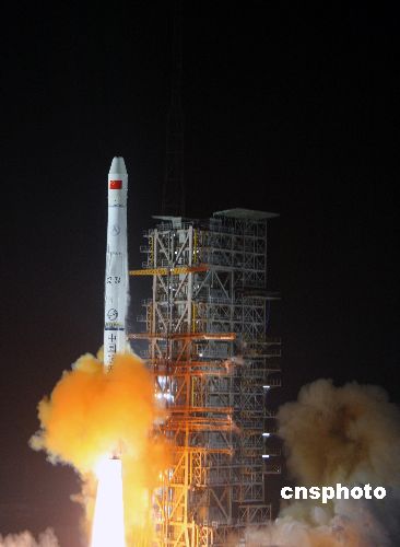
| The carrier rocket Long March 3-A blasts off from the Xichang Satellite Launch Center in southwest China's Sichuan Province, Feb. 3, 2007. |
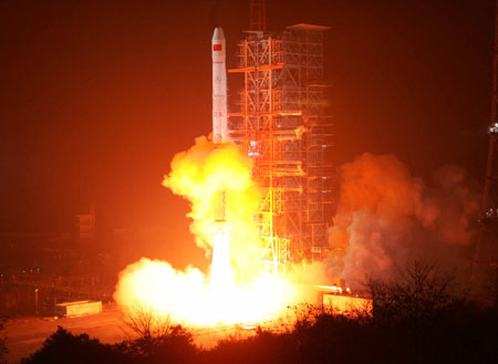
| XICHANG, Sichuan, Feb.3 - China successfully put a navigation satellite into orbit early Saturday from the Xichang Satellite Launch Center in southwest China's Sichuan Province.
The carrier rocket, Long March 3-A, blasted off at 0:28 a.m. ( Beijing Time). The satellite separated from the rocket about 24 minutes later. Data from the Xi'an satellite monitoring center showed that the satellite had accurately2 entered its orbit. It is China's fourth Beidou (Big Dipper) navigation experimental satellite in orbit. The previous three were sent in space on Oct. 31, 2000, Dec. 21, 2000 and May 25, 2003 respectively. Experts said the Beidou satellite navigation experimental system is operating well and has played a significant role in cartography, telecommunications, water conservation, transportation, fishery, prospecting3, forest fire monitoring and national security. The fourth Beidou navigation satellite, serving as a backup satellite for the Beidou satellite navigation experimental system, may replace the first Beidou satellite, when necessary, continuing to provide all-weather and all-day navigation and positioning information. Experts said China is establishing the Compass Navigation Satellite System on the basis of the Beidou satellite navigation experimental system. The compass system will in 2008 fully1 meet the demand of satellite navigation for clients in China and neighboring regions. The Compass Navigation Satellite System will gradually extend to be a global satellite navigation and positioning system after network building and experiments, experts said. The compass system will be mainly used for economic purposes, providing efficient navigation and positioning services in transportation, meteorology, petroleum4 prospecting, forest fire monitoring, disaster forecast, telecommunications and public security, among others. China is one of the several countries in the world capable of developing such a system on its own. The system can help clients know their location at any time and place with accurate longitude5, latitude6 and altitude data. The satellite and carrier rocket were developed respectively by the China Academy of Space Technology and China Academy of Launch Vehicle Technology, which are under the China Aerospace7 Science and Technology Corporation. The launch represents the 95th flight of China's Long March series of rockets.
|
点击 收听单词发音
收听单词发音 |
1
fully
|
|
| adv.完全地,全部地,彻底地;充分地 | |
参考例句: |
|
|
|
|
2
accurately
|
|
| adv.准确地,精确地 | |
参考例句: |
|
|
|
|
3
prospecting
|
|
| n.探矿 | |
参考例句: |
|
|
|
|
4
petroleum
|
|
| n.原油,石油 | |
参考例句: |
|
|
|
|
5
longitude
|
|
| n.经线,经度 | |
参考例句: |
|
|
|
|
6
latitude
|
|
| n.纬度,行动或言论的自由(范围),(pl.)地区 | |
参考例句: |
|
|
|
|
7
aerospace
|
|
| adj.航空的,宇宙航行的 | |
参考例句: |
|
|
|
- 上一篇:Fewer sandstorms in N.China this spring
- 下一篇:China makes all devices for lunar probe project on its own


©2005-2010英文阅读网